TRAPANI

|
Who arrives in Trapani from the sea, is received by an ancient Phoenician harbour, considered a strategic point of the Mediterranean Sea for his earth strip that protects the natural port. The historical origins of the city go back to the Sicani but several dominations alternate themselves on the Trapani beaches through the centuries. The testimony of the various cultural stratifications appears on the architectonic aspect of the city, as the Palazzo della Giudecca of Jewish origin. |
ERICE
| Erice is an ancient medieval town whose origins are wrapped in the legend. According to that, the town was founded by Erice, the son of Venus and Bute, the king of Elymi. At first the town seems to be solitary and surrounded by the massive town-walls, that attest Elymo-Phoenician and Punic presence. An obligatory stage is the Chiesa Madre, built during the first half of the XIV century for the will of Frederick of Aragon and dedicated to the Virgin. The charm of mystery is reflected on the little streets made of particular big squared stones and the sweet scent of furnace products, that enchants who walks through the ancient alleys. |  |
VALDERICE
 |
At 7 Km from Trapani, there is Valderice. It is situated in the big valley on Erice Mount, Valderice is the ideal place to have a beautiful holiday, for its typic Mediterranean weather. During the year Valderice is rich of cultural, artistic, and sporting events: the fascinating Valderice Summer in the amphitheatre of San Barnaba, the Carnival parade and the racing Monte Erice, the Christmas and Easter events. |
ISOLE EGADI
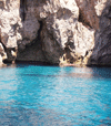 |
The Egadi Islands are more interesting from a naturalistic than a tourist point of view. Favignana, Levanzo and Marettimo are the three islands of the archipelago that seem some reflected mirrors, even if they conserve their particular aspects, both for their position and for their landscapes. Favignana, the bigger of the three islands, conserves some buildings of a certain artistic value as some little baroque churches and Palazzo Florio. |
MOZIA
| In the far-northwest coast of Sicily, a big expanse of sea with four small islands, just a little out of water, catches the passenger sight. The Stagnone lagoon is a part of sea that extends from Punta D'Alga to Birgi-San Teodoro . In the middle of this lagoon you find the small island of San Pantaleo, the Phoenicians Motya and near the other two islands: Santa Maria and Scuola. The most interesting places in Motya are: the tophet, a sacred area which is mentioned in the Holy Bible, and the Cappiddazzo, where are the remains of a shrine. In Motya, you find also the Whitaker Museum, it conserves material that comes from ancient and recent digs. | 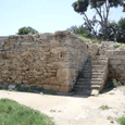 |
PANTELLERIA
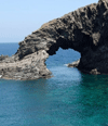 |
Pantelleria is the largest island off Sicilian coastlines, it is situated in the middle of Sicilian Channel and it extends for about 83 Km and forms the emerged part of a volcano. Going around Pantelleria you can visit the Lago or Specchio di Venere and the villages of Tracino and Khamma. From Tracino to the sea you can admire the Arco dell'Elefante (a big rock on the sea that seems an elephant) then going forward towards the left-side you arrive in Cala Levante and Cala Tramontana, you find the most beautiful sea of the whole island and some VIPs beautiful houses. When the night comes, the right place to rest is the Dammuso, a typical construction of Pantelleria. |
CASTELLAMMARE DEL GOLFO
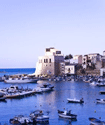 |
Castellammare del Golfo was born as port of the Elymo villages of Erice and Segesta. In the port there is the massive Arab fortress. In the centre of the city is situated the Mother Church, built in 1500's. Inside of it, you can find a statue of majolica of 1600's, representing the Holy Virgin. Today Castellammare is a point of tourist attraction that offers, from a naturalistic point of view, beautiful landscapes. |
Riserva Naturale "ZINGARO"
| The first natural reserve instituted in Sicily that extends for about 7 Km. It is situated between Scopello and San Vito lo Capo, the two main entrances. You can have a walk around the reserve only by foot and seeing a various and rich fauna and flora, the presence of some fantastic caves as the Uzzo Cave and different beaches. | 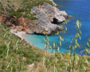 |
SELINUNTE
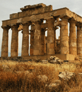 |
The archaeological site extends from the Castelvetrano hill to the sea, his surface is of about 10 Km². In this place, for about three centuries, there was the meeting and the fight between Greek and Phoenicians-Punic people. The visit of the ruins begin from oriental temples, called with alphabet letters because we don't know certainty to whom they were dedicated. Our tour continues through the Acropolis, where we find six temples and various religious buildings. |
ALCAMO
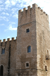 |
Alcamo is situated in the statums of the Bonifato River. It was born with the name of Manzil Alquamah, during the Arab domination in Sicily. It is between the Castello of the Monte Bonifato and that of Calatubo. The most ancient nucleus of the centre presents obvious 300's structures, on the top of them we find the most important architectonic reliefs of the period: the Castle, the Market Place, the Mother Church and the Convent of the Franciscans. The main economic activities of the city are: agriculture, the main sector is the coltivation of grapes and commerce - very developed are the sectors of building with working of marble and handicraft with working of wood, plastic, wrought iron and embroidery. |
BUSETO PALIZZOLO
| Extended settling of 1700's origin, formed by different houses and villages. Among agricultural products we remember: grain, grapes, olives and melons. There are also ovines breedings. The name Buseto comes from a Latin word and it means boxwood plant, and Palizzolo, instead, is a local surname. Very picturesque is the celebration of the death and passion of Jesus Christ. Some young people stay still on some wagons for all the time of the procession, where they represent the Holy scenes. These wagons are all the time accompanied by musical bands. |  |
CALATAFIMI
 |
Calatafimi is comprised in the Trapani province and collects more than 8000 people. It's famous not only for its position on a hill and for its agricultural centre, but also for its history. We have to remember, to give a complete sight on its history, that Calatafimi is linked to the events of Garibaldi and his famous military expedion of 1089 volunteers. The fight with the Bourbons in 1860, won by Garibaldi is remembered in the Monumento Ossario, in Colle Pianto Romano. |
CAMPOBELLO DI MAZARA
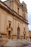 |
The zone of Campobello di Mazara is formed of more than 12478 people and rises on a hill, at 110 meters above sea level. It is an agricultural-industrial centre, known for its olives production and factories. Inside the main church "Santa Maria delle Grazie", it is possible to admire the beautiful Crucifix of Frà Umile da Petralia. There is also the famous Clock Tower and the fantastic church of San Michele. In the nearest zone you can visit The Cusa Cave, from where the people of Selinunte took some calcareous tufa to realize temples. |
CASTELVETRANO
| Castelvetrano is an agricultural centre where developed activities linked to the cultivation of grapes, olives and wood. In the centre of Castelvetrano we find two near squares, Umberto I square and Garibaldi square, that contains the most important monuments of the town. |  |
CUSTONACI
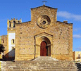 |
Custonaci is an agricultural centre that is comprised in the Trapani province with more than 4600 people. Its territory includes the high summit on Sparagio Mountain (1100 meters) where we find a big green zone, the Giacalamaro Forest. The economy is based first on extraction and working of marble: this activity gives the possibilities to obtain some important varieties of marble for example: Playa Grey, Sicilian Cream, Pearl, Perlatino and Red Energy. |
GIBELLINA
 |
Gibellina was destroyed by the earthquake which strucks the Belice Valley in 1968. The ruins are still visible (follow the signs for Ruderi di Gibellina, 18km west of Gibellina Nuova), although many have been petrified into a work of art called Cretto (Crack) by Burri. Indeed much of what used to be the streets of the old town have been "veiled" in a gentle concrete blanket furrowed by cracks. Gibellina Nuova has been rebuilt as an embodiment of a highly peculiar concept: to design the town as a kind of permanent museum with sculptures scattered through the streets and among the buildings, which in turn could be seen as individual works of art, including the imposing Star at the entrance to the town by Pietro Consagra, Quaroni's Piazza del Municipio with its musical tower, and his great white spherical Chiesa Madre that dominates the landscape from miles around. |
MAZARA DEL VALLO
| This settlement founded by the Phoenicians at the mouth of the River Mazaro became animportant harbour in Antiquity on account of its protected position and its proximity to Africa. Mazara was an important Greek commercial centre, it reached its maximum splendour under Arab and then Norman dominion. The mixture of the people, due to the different dominations, is still very evident. Mazara is still now considered as one of the most important deep-sea fishing-towns in Italy, accounting for 20% of the national catch. | 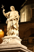 |
PACECO
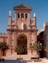 |
Agricultural centre (58,41 Km² with 11000 people). It is at 7 Km in the south east from Trapani, at 690 meters above sea level. The centre of the city is situated very near of the big salt marshes of Trapani.Paceco is a seismic zone of second category and besides marble factories and the activity of salt marshes it has an agricultural economy. |
PARTANNA
 |
This town was hardly destroyed by the same earthquake that destroyed Gibellina in 1968. It introduces itself with its embattled castle (XVII century), re-edified with an old Norman castle for the will of the Graffeo family. From the square, behind the castle, you can see a beautiful landscape. |
PETROSINO
| Petrosino is a little town of 45 Km² with 6900 people, it is at 13 Km South-East from Marsala, at 16 meters above sea level, near the coast. It became in 1978 an indipendent city, detaching from Marsala. |  |
POGGIOREALE
 |
Agricultural cantre of 37,53 Km² with 1900 people at 65 Km South-East from Trapani, at 393 meters above sea level in the Belice Valley. Its territory is formed by calcareous tufa. Sismic zone of first category in fact it has completely destroyed with the earthquake of 1968. Its agricultural and zootechnical economy endured a process of impoverishment after the earthquake. |
SALAPARUTA
 |
Salaparuta is situated on a slope in the province of Trapani at 200m above sea level. It collects about 2.000 people. The main building in town is the main church with a fine 1400's statue of Santa Caterina. |
SALEMI
| Salemi is at 37 Km South-East from Trapani, at 446 meters above sea level between the Delia and Mercanzotta rivers. It is a seismic zone of first category, the centre was destroyed by the earthquake of 1968. Salemi has a various economy: grapes, fruits, cereals, olives, cotton and vegetables then also bovines, ovines and equines. Don't lack handicraft and industrial activities. |  |
SAN VITO LO CAPO
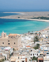 |
San Vito lo Capo rises on the North-West coast of Sicily, it is ituated in the bay between the natural reserves of Zingaro and Cofano Mount. It is the city of cous-cous, the peace dish, a symbol of integration between different people and cultures. San Vito lo Capo is an old maritime harbour that preserves the strong Arab stamp. In this place, light, scents and flavours give life to a landscape made by Mediterranean colors and beautiful depths: you can see tiny houses covered with buganvillea and a beach with white sand and a sky-blue sea that extends more of 1 Km, towards the Mediterranean Sea. |
SANTA NINFA
 |
Santa Ninfa developes at 410 metres above sea level, inside Trapani province. It collects about 5400 people. The city was founded by Luigi Arras Giardina, after the famous earthquake it had a big phase of re-built. Santa Ninfa is remembered for its ruins of the old centre and of the Church and the Convent dedicated to Sant'Anna. |
SEGESTA
| The famous Doric temple of Segesta is situated in a beautiful position, among the dark hills that forms a nice contrast with the green around. The old Segesta, founded probably by Elyms, as Erice, became soon one of the main Mediterranean cities of the Hellenistic influence. In the V century it is the biggest enemy of Selinunte. |  |
MARSALA
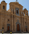 |
The main monument of the city is the cathedral dedicated to Saint Thomas of Canterbury and founded in the Norman Age. On the back of the cathedral, the Museum of the tapestries is located, that's cultural expression of Flemish art handed us on from the far 500. Through the centuries the various dominations left important architectonic testimonies, but the main building, so far discovered, and the Thermal Baths of the III-IV century A.D. are due to the Romans. A Punic ship, a precious archaeological jewel, can be admired at the archaeological Museum of Baglio Anselmi. The pearl of Marsala and the Italian wines is the Marsala Wine that, discovered by English people more of two centuries ago, is one of the most important wine abroad today. |


